Our objectives: are to create a detailed map of the sea bed of the Channel Islands region to detail our marine habitat, uncover heritage and create a completely new set of nautical charts
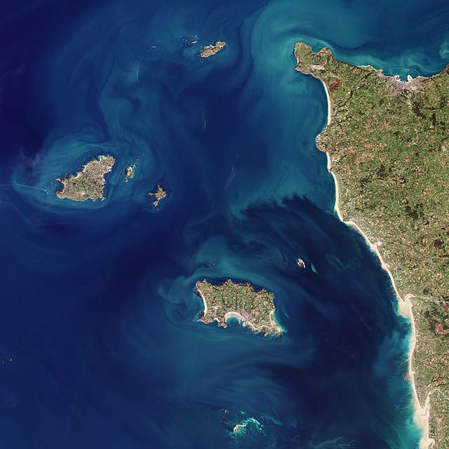
Only 5% of the Channel Islands’ waters have been mapped with detailed bathymetric data.
This lack of comprehensive geo and habitat information hampers effective marine management, conservation efforts, and scientific research. Without accurate data, it is challenging to protect critical habitats such as seagrass beds, maerl beds, and kelp forests.
Hazards
Channel Islands’ waters can be extremely treacherous and a key aim of the project is to address SOLAS concerns and provide a fully updated data set for modernising our navigational charts, thereby reducing danger to life and damage to vessels.
Much of the data for the Channel Islands’ navigational charts was collected in the 1870’s using rowing boats, sextants and lead lines to build the bulk of what we still rely on today for navigational purposes. This makes them unusually outdated. The International Hydrographic Organisation (IHO) has various charting standards, the most accurate of which is Standard 100 – S-100.
A key project aim is to deliver a fully up-to-date suite of navigational data to conform with S-100, leading to enhanced safety at sea and the potential for increased maritime tourism.
Heritage
Studies in Normandy and Brittany have discovered mesolithic archaeological sites and there is a strong chance that such sites are waiting to be discovered in channel Island waters.
In addition to finding archaeological sites Subsee believes that there could be low thousands of unidentified shipwrecks in Channel Island waters stretching back through 8,000 years. the remains of two Roman ships have been found in Guernsey and one World war 1 U-Boat has been discovered on the sea bed in extraordinary condition. Other famous wrecks remain to be located
Divers from Guernsey have discovered a missing German U-Boat at a depth of over 70 meters. The missing U-boat ‘UC-18′ was lost in February 1917 after a famous battle with a secret Royal Navy ‘Q’ Ship which was also sunk in the altercation. There are many more stories like this waiting to be discovered.
We have very significant data gaps in our knowledge of our seas.
SUBSEE has been set up to address these gaps and has a plan to make the Channel Islands regional seas the best documented in the world from a scientific, heritage and navigational point of view.
We are building a comprehensive 3D model of the sea floor, which will provide detailed topography (bathymetry) data. Currently, only about 5% of our waters have this data.
Purpose
To accurately map the locations of sea grass, maerl beds, kelp, and other marine fauna.
Goal
To create a fully updated and precise view of our marine environments, which will help in protecting fish spawning grounds and other critical habitats.
Utilize three different sonar systems for comprehensive data collection.
Multi-Beam Echo Sonar:
Gathers detailed bathymetry data beyond satellite coverage.
Sub-Bottom Profiling:
Penetrates subsea sediment for geological insights.
Scientific Wide Band Echo Sonar (EK80):
Monitors marine biodiversity.
Utilise World Leading Tech
Phase 1
> Open-source data, satellite-derived
bathymetry and seafloor classification
Phase 2
> Airborne lidar bathymetry
(and hyperspectral imaging)
<~20m water depth
Phase 3
> Multibeam echosounding
(and sub-bottom profiling)
>~20m water depth
Phase 4
> Data fusion, AI analytics,
insights delivered via a digital
twin platform
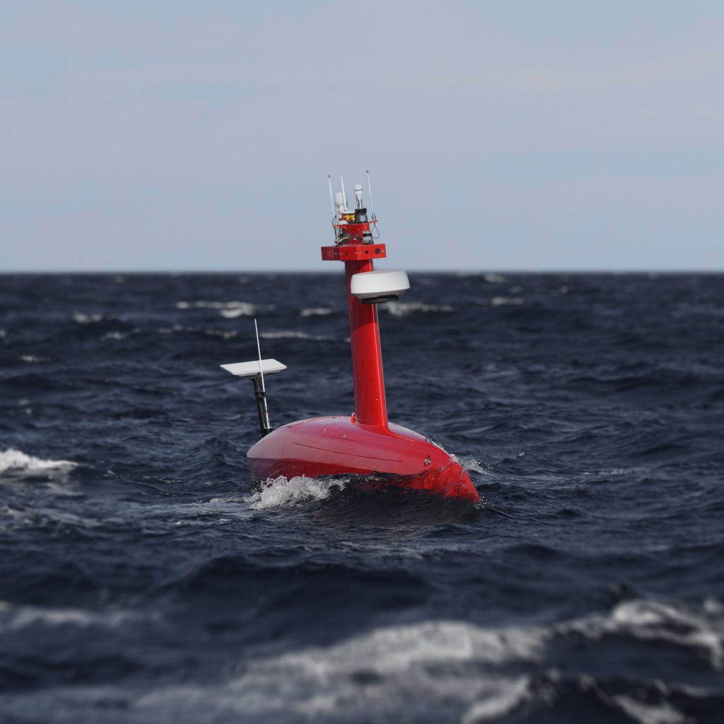
Unmanned Service Vehicle
An example of the kind of technology to be deployed – The DriX is a versatile, efficient, and durable unmanned surface vessel for coastal and offshore monitoring, hydrographic surveys, and AUV tracking, offering enhanced safety and reduced environmental impact.
Capabilities
> Powerful enough to handle tidal and current systems around the Channel Islands.
> Equipped with a gondola beneath the vessel to house the sonar technologies.
Execution
> Survey Duration: 365 days of in-water operations spread over 18 months.
> Data Streaming: Live data streaming via Starlink, incrementally building the data set into the model.
Additional Data Collection Methods:
eDNA Surveys
Acoustic Data:
Collected from fiber optic cables.
Seabed Landers:
Four specialized landers anchored on the seabed will provide ongoing data on salinity, chemical composition, currents, and acoustics, continuously feeding data into the model.
Benefit
Comprehensive Marine Insights: The integration of satellite, sonar, and additional scientific data ensures precise, real-time marine analysis, enhancing navigation safety and environmental monitoring.
Who?
The project brings together expertise from various domains, including climate mitigation, automated information systems, and marine biology.
action
With a strong foundation and a network of dedicated partners, SUBSEE is poised to accelerate ocean protection.
Help safeguard our most precious resource THE OCEAN